Accurate Identification, Imaging and Monitoring of Fluid-Saturated Underground Reservoirs
IB-1663APPLICATIONS OF TECHNOLOGY:
• Search for and contouring of gas and oil deposits
• Underground water reservoir imaging
• Estimation of the size and shape of contamination zones
• Monitoring of underground liquid and gas storage
• CO2 sequestration problem
ADVANTAGES:
• Allows characterization of subsurface fluid reservoirs in situations where other approaches fail
• Improves imaging of thin, porous saturated layers
• Substantially improves the accuracy of imaging of any porous rocks using surface and/or borehole seismic measurements
• Enables differentiation between oil and water
• 80% success rate with a variety of data sets
ABSTRACT:
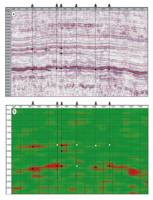
Thin porous layers are effectively invisible to current seismic methods used for reservoir imaging. Since gas and oil deposits are usually attributed to fluid-saturated porous layers, Gennady Goloshubin and Valeri Korneev have developed an imaging method that provides a more accurate determination of saturation character for subsurface reservoirs. Berkeley Lab's new technique that takes into account a low frequency seismic response will allow improved imaging of thin porous liquid saturated layers (containing gas, water, oil, etc.), and substantially improve the accuracy of imaging of any porous rocks using surface and/or borehole seismic measurements.
Use of seismic low frequencies has strong potential for prognoses of fluid content and mapping of productive highly permeable zones of reservoirs. The low-frequency effects are especially important when no noticeable fluid signature is found in the high-frequency domain of seismic reflections from the oil-saturated reservoirs. Frequency-dependent seismic imaging allows the characterization of the subsurface fluid reservoirs in situations where other approaches fail.
To date, the low frequency imaging approach has been applied to a variety of data sets. It worked well in about 80% of the cases, while in other cases the interpretation outcome was uncertain. The limits and conditions of the method need to be further investigated so that the imaging procedure can be adapted to each case depending on the geology, data quality, frequency content, etc.
This technique will find applications in the search for and contouring of gas and oil deposits, as well as in underground water reservoir imaging, estimation of the size and shape of contamination zones, monitoring of underground liquid and gas storage, and, generally, in the global CO2 sequestration problem.
Attached files:

Patents:
US 6,941,227
Type of Offer: Licensing
« More Earth Sciences Patents