Big Data for Improved Flood Risk Predictions
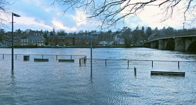 Scotland is a very wet country with an abundance of rainfall. Heavy rains and flooding puts lives, homes and businesses at risk and makes an annual dent in the economy to the tune of around £53 million (approx. $USD 67 million).
Flood-related problems are expected to get worse due to climate change. So, to help prepare for such eventualities and to make better-informed decisions authorities are turning to big data.
The Scottish Environment Protection Agency (SEPA) is spending the next few months in an island chain known as the Outer Hebrides to gather robust data using state-of-the-art aerial surveying technology. This will make use of laser technology to build a detailed digital three-dimensional model of Scotland's terrain and will help improve current flood risk models.
“It basically involves building a three-dimensional map of the terrain to help us understand in greater detail than we currently have which areas are most at risk from flooding,” explained project co-lead Pascal Lardet, SEPA’s flood warning and informing unit manager.
Urgent Need for Big Data
With worrying predictions about climate change being made in numerous reports and by many scientists the need for this kind of data collection is a pressing one. The impact of climate change on the country's most flood-prone communities is projected to put nearly 200,000 homes and businesses at risk of flooding by 2080.
Lardet continued: “All these new data will enable us to develop a state-of-the-art coastal flood forecasting system over the next two years.”
Add your Comment
[LOGIN FIRST] if you're already a member.fields are required.